

This tutorial shows you how to use urban planning CFD to model airflow around buildings! CFD for urban design helps city planners understand how tall buildings change wind patterns and affect people’s comfort on streets. Using computational fluid dynamics in urban planning is now super important for creating comfortable and safe city environments. This step-by-step guide teaches you how to set up an urban airflow simulation in ANSYS Fluent to study problems like wind tunneling effects between buildings, dangerous pedestrian level winds, and urban heat islands. You’ll learn to visualize urban wind flow and predict pollution dispersion in cities without expensive physical models. Urban microclimate modeling with CFD helps planners make better decisions about building height, spacing, and orientation to improve outdoor comfort. Architects and engineers use these urban CFD simulations to test new designs and fix wind problems in existing city layouts. Whether you’re designing new neighborhoods, studying urban ventilation corridors, or analyzing wind comfort around skyscrapers, this guide makes complex urban flow modeling easy to understand. Perfect for beginners wanting to learn CFD for sustainable city planning or professionals needing to assess wind safety around tall buildings!
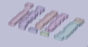
Figure 1: Buildings blocks captured from ArcGIS photos
Simulation Process
We started our urban CFD model by getting real city data from ArcGIS photos of actual buildings and streets. These photos helped us make an accurate 3D city model in ANSYS SpaceClaim, where we created all the building shapes and the ground surface. Next, we took this model into ANSYS Meshing to create a special grid that divides the air space into millions of tiny calculation cells. We made the mesh extra fine near buildings and streets where wind changes direction quickly. For the wind flow simulation, we set up a big box around our city model with wind coming in at 7.4 m/s from one side.
Post-processing
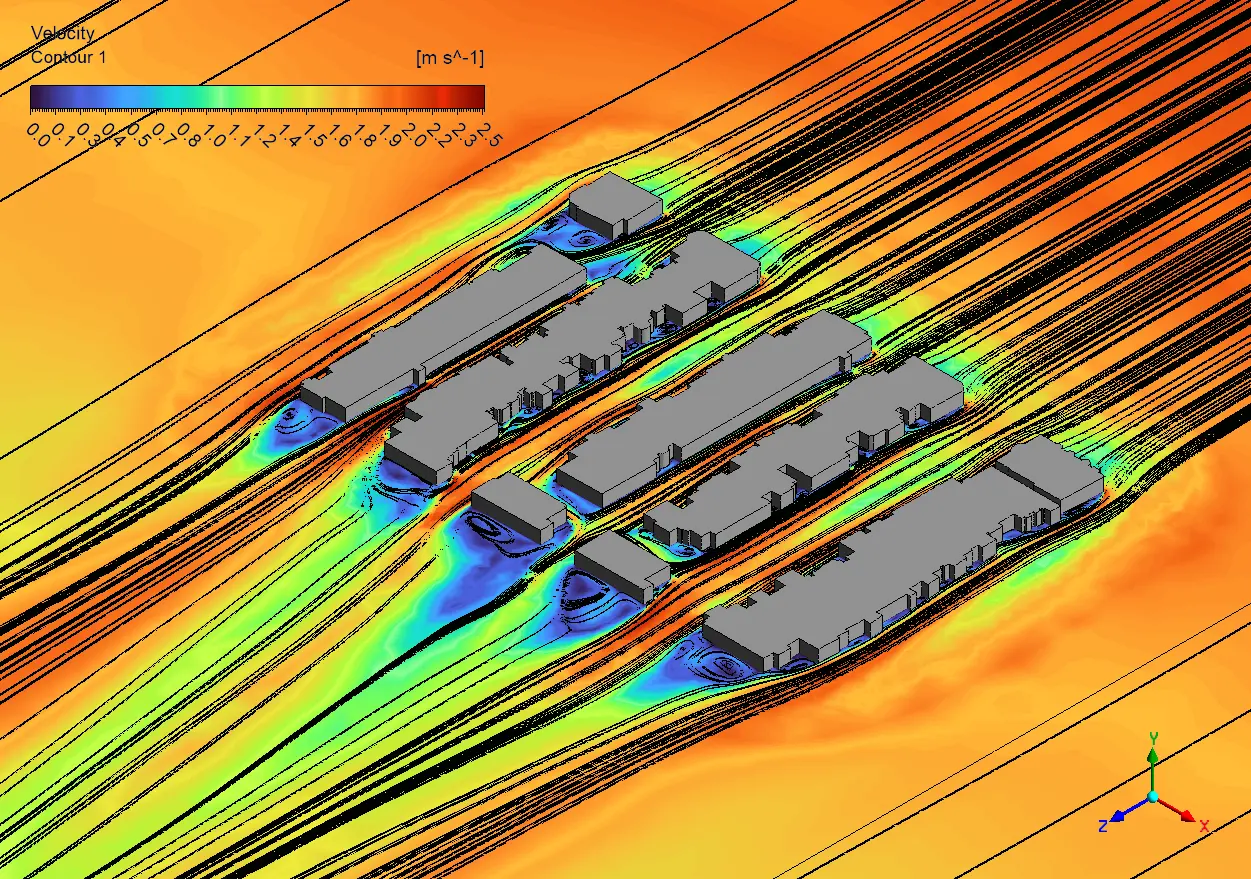
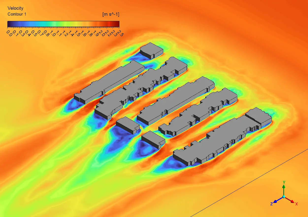
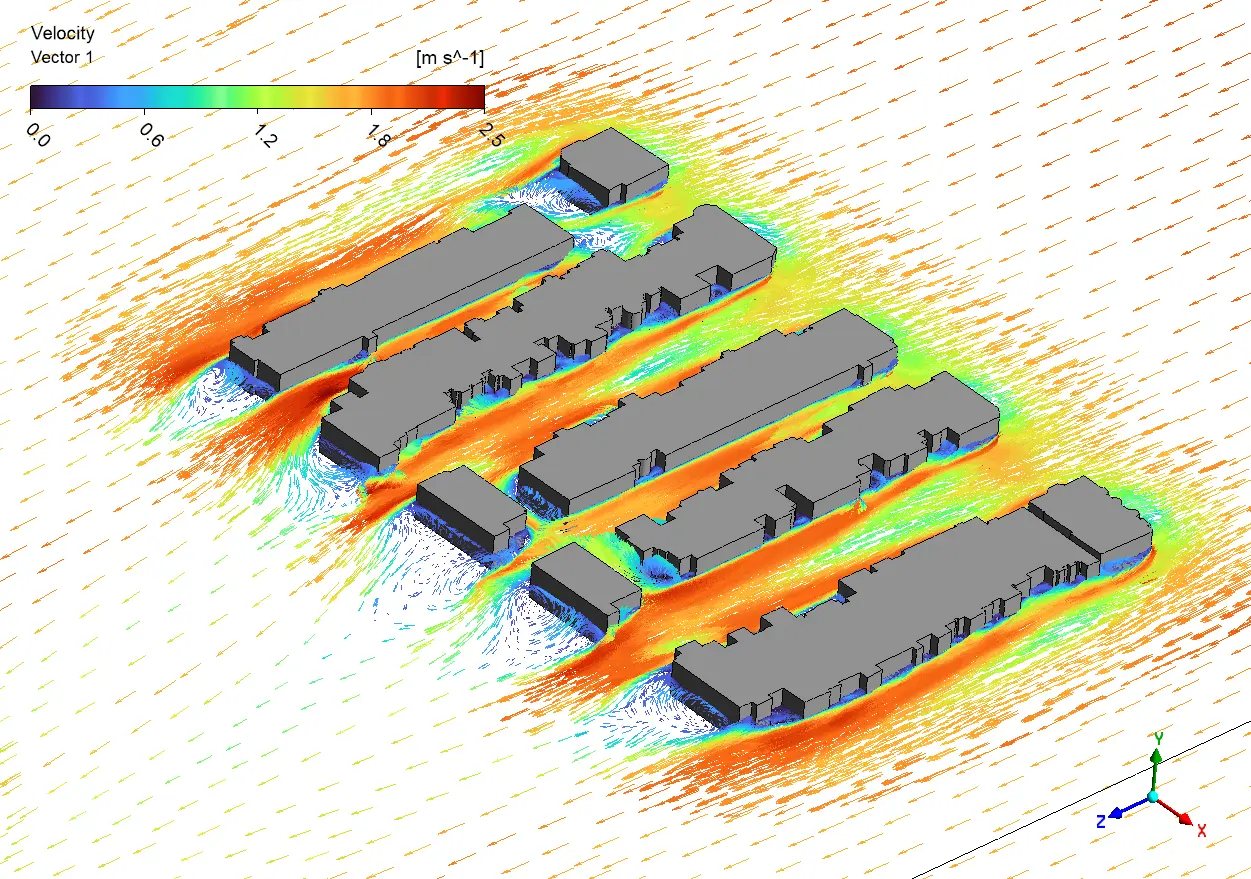
The velocity vectors reveal fascinating urban wind patterns that would be impossible to predict without CFD simulation. The most striking feature is the powerful wind channeling effect between the parallel building blocks, where wind speed accelerates from the ambient 7.4 m/s to nearly 11 m/s (red areas) – a 50% increase that would create significant pedestrian discomfort at ground level. This channeling happens because the buildings create a “canyon effect” that squeezes the same amount of air through a smaller space. From an urban planning perspective, these results show why placing benches or outdoor cafes in these corridors would be a terrible idea – winds above 5 m/s are generally considered uncomfortable for sitting activities. The blue regions behind buildings show classic recirculation zones where wind reverses direction and creates small “wind shadows” with speeds below 1 m/s. These areas could potentially trap pollutants but might also provide comfortable spots for pedestrian activities during hot weather.
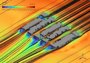
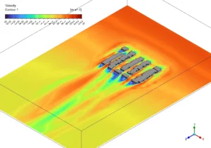
Figure 2: Pedestrian Level Wind Speed Contours & Streamlines
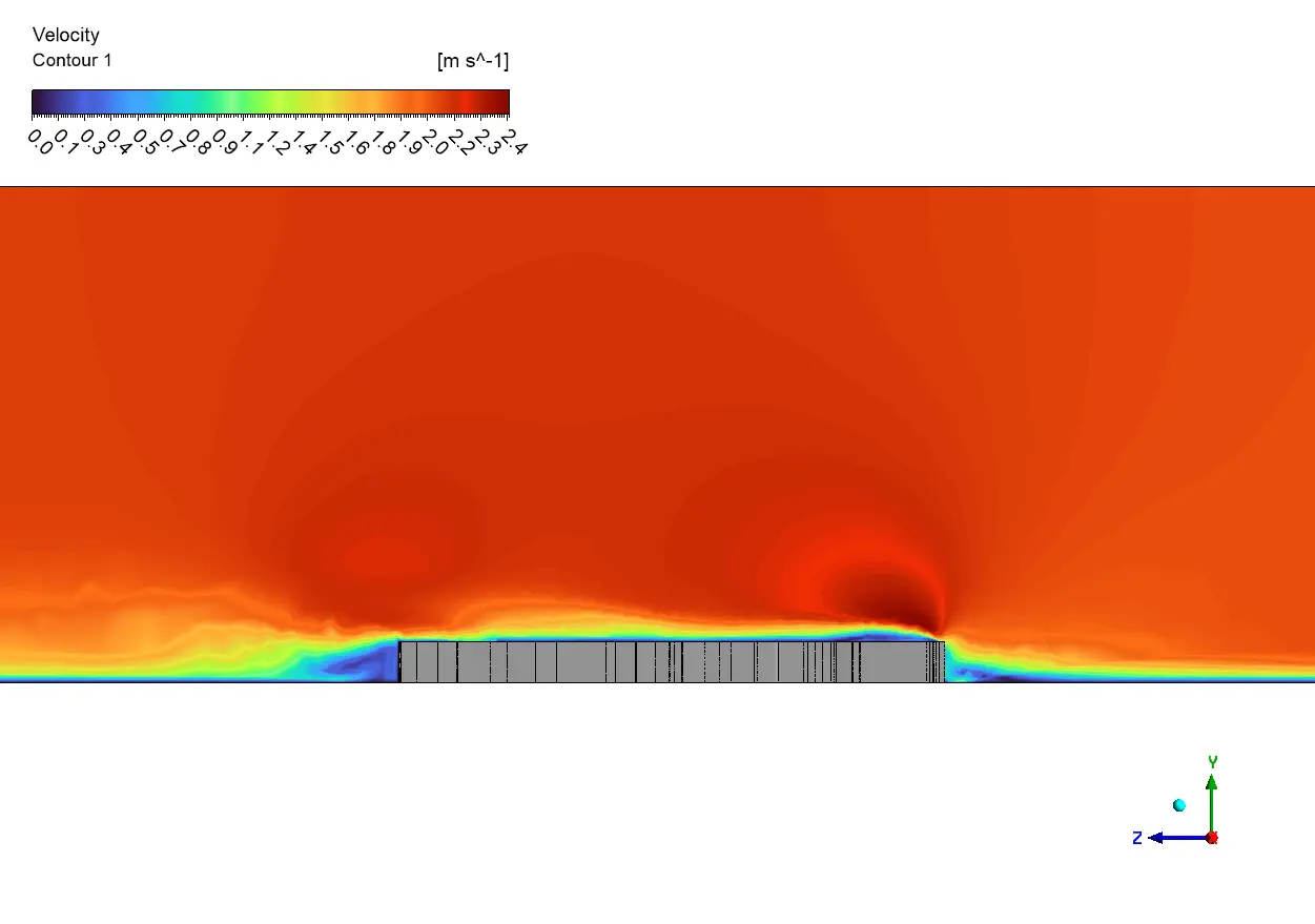
The streamlines in the third image beautifully demonstrate how building aerodynamics transforms the otherwise straight wind flow. Notice how the front corners of each building create distinctive vortices that spiral downward – these corner effects can create dangerous localized wind gusts that might knock over pedestrians or cyclists. From an urban design perspective, these results suggest several practical improvements: adding rounded corners to buildings could reduce these dangerous corner vortices; staggering building positions rather than perfect alignment would disrupt the strong wind corridors; and strategically placing trees or wind screens near building corners would improve pedestrian comfort in problematic areas. The wind velocity differences shown in the contour plots also explain why some urban spaces feel dramatically different even when they’re just a few meters apart – the urban microclimate varies tremendously based on building geometry. For city planners, this type of wind flow simulation provides crucial data that traditional wind tunnel tests can’t easily capture at this detail level.
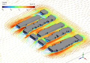
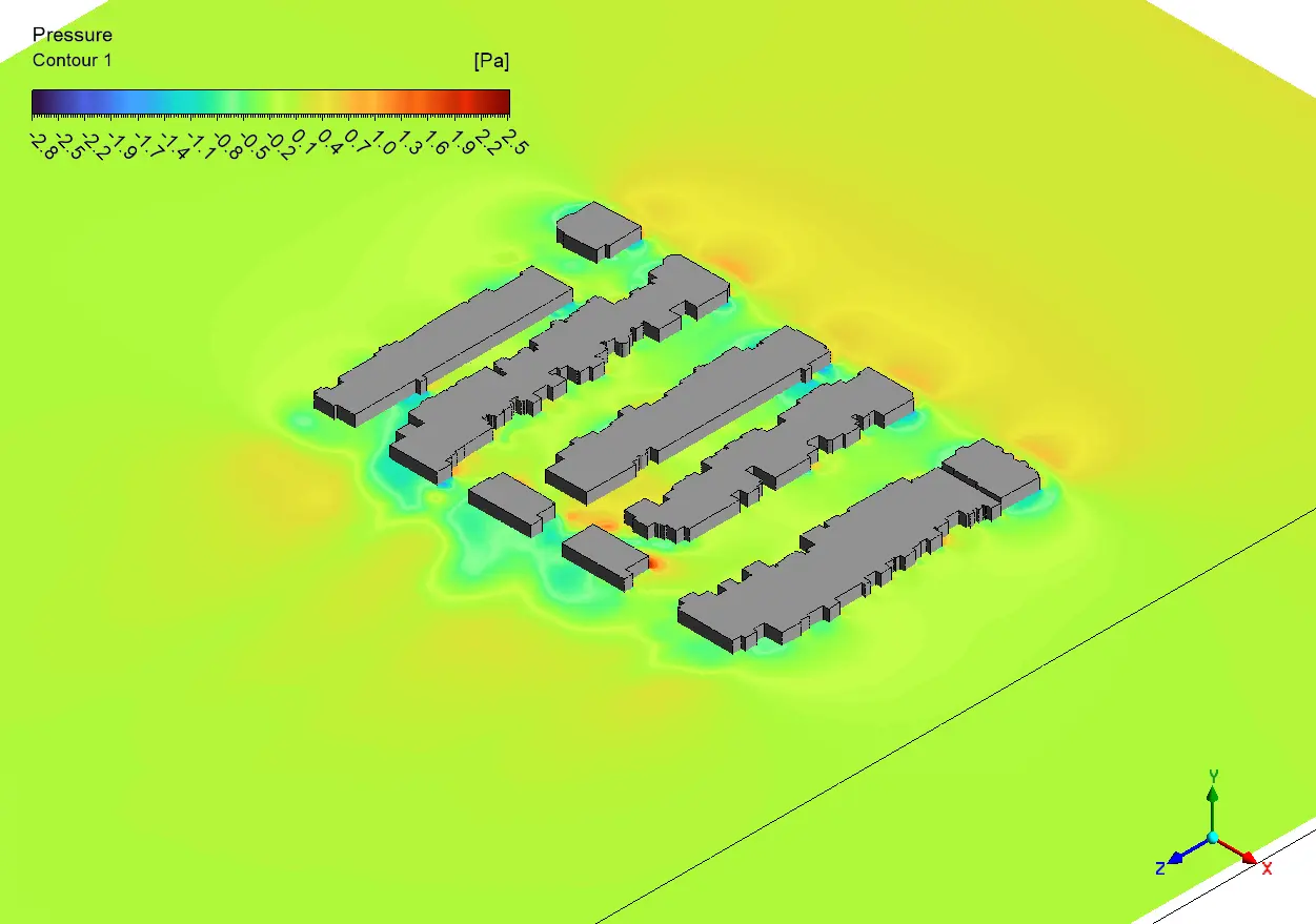
Figure 3: Velocity Vectors Around Building Layout


Reviews
There are no reviews yet.